Site and Monitor Selection Planning
Choosing the right locations for your air quality monitors is a critical step in establishing an effective monitoring network. The quality of your data, and therefore the insights you can gain, directly depends on where you place your monitors. Careful site selection ensures you collect data that accurately represents the air quality you want to understand and address. Poorly chosen sites can lead to inaccurate readings and undermine your monitoring efforts.
This chapter guides you through the essential considerations for selecting appropriate locations for your air quality monitors. By following these guidelines, you can maximize the value of your monitoring project and contribute to a clearer understanding of air quality in your community.
Based on the locations where you plan to measure air pollution levels, this chapter will also assist you in selecting the appropriate monitor model.
Key Highlight
There are three monitors to choose from:
- Open Air (O-1PST) - Wifi
- Open Air Cellular (O-1PST-CE) - Cellular
- Open Air Max (O-M-1PPSTON-CE) - Cellular with Solar Panels
Choosing the right locations for your air quality monitors is paramount for collecting accurate and representative data. Careful site selection ensures your monitoring efforts provide meaningful insights and contribute to effective air quality management.
Section 2 of this Chapter provides a checklist to summarise your site selection process.
1. Key Considerations for Site Selection
Selecting optimal locations for your air quality monitors involves considering practical and environmental factors.
1.1. Alignment with your project aim
In the project overview you created in Chapter P2: Defining Your Air Quality Project you identified your target population and the type of air pollution you aim to monitor (regional vs. local pollution). Your top priority should be selecting monitoring sites that align with these objectives.
For example, if you’re studying air pollution’s impact on students, place sensors in and around schools. If you’re assessing the effect of air pollution mitigation policies on the overall citywide air quality, distribute sensors evenly across the city and away from direct emission sources, to capture overall regional pollution levels.
1.2. Practical Requirements
Practical factors are crucial for ensuring your monitors operate reliably and are easy to manage:
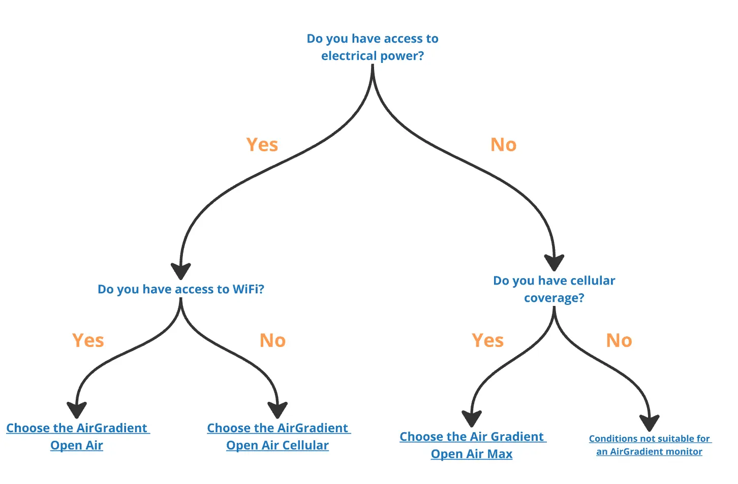
Power Access: Monitors need a consistent power supply. Assess the availability and reliability of power at potential sites. Is a power source readily accessible and stable? For USB-powered monitors, ensure power sockets are within a reasonable distance. If access to power is unavailable, AirGradient also offers monitors with solar panels.
Network Stability: For monitors that transmit data wirelessly, a stable network connection is essential. For WiFi monitors, check WiFi signal strength. For cellular monitors, assess cellular coverage. Consider potential signal obstructions from walls and buildings.
Accessibility and Logistics: Choose sites that are easily accessible for installation and maintenance. Avoid locations that are difficult to reach or dangerous. Consider site security to minimize vandalism or theft. Ensure deployments are safe for the public and comply with any necessary regulations. Obtain permissions if deploying on public or private property.
Proximity to Reference1 Station: If data accuracy is very important and the area of deployment has reference stations, these should also be considered in the network planning. Ideally 2-3 low-cost monitors should be permanently installed near the reference station in order to be able to continuously calibrate the network.
1.3. Site Security
Ensuring the security of your air quality monitors is crucial for maintaining continuous data collection and preventing damage or theft. The choice of monitor placement should balance feasibility, accessibility for maintenance, and protection from tampering. Below are common deployment locations and their key considerations:
| Location | Security | Permissions | WiFi and Power | Comments |
|---|---|---|---|---|
| Street Lamp Posts | low | Municipality | no | Wide coverage. Good for monitoring traffic pollution. Elevated installation and community engagement can help mitigate the risk of vandalism or theft. |
| Public Buildings | High | Public authorities | yes | High visibility for public engagement. |
| Private Balconies | High | Private owners | yes | Coverage depends on willingness of private owners. |
| Schools | medium | School authorities | yes | High visibility for public engagement. Good for educational outreach and awareness. Student engagement mitigates the risk of vandalism or theft. |
| Commercial Buildings | high | Business owners | yes | Potential for business partnership support. |
Additionally, placing monitors in locations that are visible yet not easily accessible, such as near security cameras, gated properties, or elevated surfaces, can help deter vandalism and theft. Building community awareness and ownership also plays a critical role; informing local residents, shop owners, or institutions about the purpose of the monitors fosters a sense of shared responsibility, increasing the likelihood that they will help protect and maintain the equipment. In areas with a higher risk of tampering, using secure mounting solutions, protective enclosures, or weatherproof casings can further enhance durability. Additionally, when installing monitors on public or commercial property, it is important to coordinate with relevant authorities to obtain the necessary legal permissions and ensure compliance with local regulations. By addressing these factors early on, you can maintain data integrity while preventing unnecessary disruptions to your monitoring project.
Refer to Community Engagement Chapter to guide you on how to engage with your community.
1.4. Environmental Factors
Environmental conditions at the deployment site are important for accurate measurements and monitor durability:
Distance from Pollution Sources: The placement of your air quality monitor should align with your monitoring goals. If you want to measure regional pollution or general air quality across a city or neighborhood, place the monitor away from specific sources of pollution (e.g. car exhausts or construction sites) to capture a broader, more representative reading. However, if your goal is to have localized pollution data to study the impact of a particular pollution source, such as traffic emissions, industrial zones, construction sites, or waste burning areas, you should position the monitor closer to that source to observe direct effects. At the same time, it is useful to place additional monitors further away to compare the data and understand how pollution spreads or diminishes over distance.
Wind Exposure and Airflow: Good natural airflow is important for representative air quality readings. Avoid areas where there is no wind flow or enclosed spaces. Be mindful of obstructions that can block wind, and prefer open, naturally ventilated locations.
Proximity to Trees and Vegetation: Avoid placing monitors directly on or very close to trees and dense vegetation. Trees can attract insects that may interfere with sensors, and vegetation can obstruct air inlets.
Proximity to Reflective Surfaces: Avoid placing monitors directly next to heat-radiating surfaces like concrete or asphalt, as these can influence temperature readings.
2. Step-by-Step Site Selection Process
Follow these steps to select your monitor locations:
- Map Potential Locations: You can use, for example, the Google Maps function “My Maps” to identify and mark potential sites. This feature is explained in more detail in the FAQ section.
- Use the Checklist below to assess the characteristics of each potential site. Conduct Site Visits of the most promising locations to verify your assessments and test cellular signal strength (in case there is no WiFi).
- Prioritize and Select Sites: Choose sites that best balance practicalities, environmental factors, and monitoring objectives.
3. Site Checklist
Use this checklist to guide your site selection process:
| Checklist Item | Considerations/Notes |
|---|---|
| Power Source Available and Suitable? | Is there a reliable power source nearby? |
| Network Signal Strength Adequate? | Is WiFi or cellular signal strength sufficient at the location? |
| Location Easily Accessible? | Is the site easily accessible for installation and future maintenance? |
| Site Secure? | Is the location reasonably secure from vandalism or theft? |
| Deployment Location Safe? | Is the deployment safe for the public and compliant with safety regulations? |
| Permissions Obtained (if needed)? | Have necessary permissions been obtained for deployment on public or private property? |
| Appropriate Distance from Pollution Sources? | Is the distance from pollution sources appropriate for your monitoring objectives (general air quality vs. source-specific)? |
| Good Wind Exposure and Airflow? | Does the location have good natural airflow, avoiding stagnant air? |
| Away from Trees and Vegetation? | Is the location away from trees and dense vegetation to minimize interference? |
| Away from Reflective Surfaces? | Is the location away from surfaces that radiate heat and might affect temperature readings? |
| Site Tested and Confirmed? | Have you tested power and connectivity at the site before permanent deployment? |
| Site Selection Rationale Documented? | Have you documented your reasons for choosing this site, including assessments of practical and environmental factors? |
4. Selecting Appropriate Monitors
AirGradient offers different monitor models with varying connectivity. Make sure you get the correct monitors for the selected site characteristics.
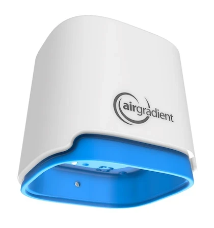
Open Air Cellular (O-1PST-CE)
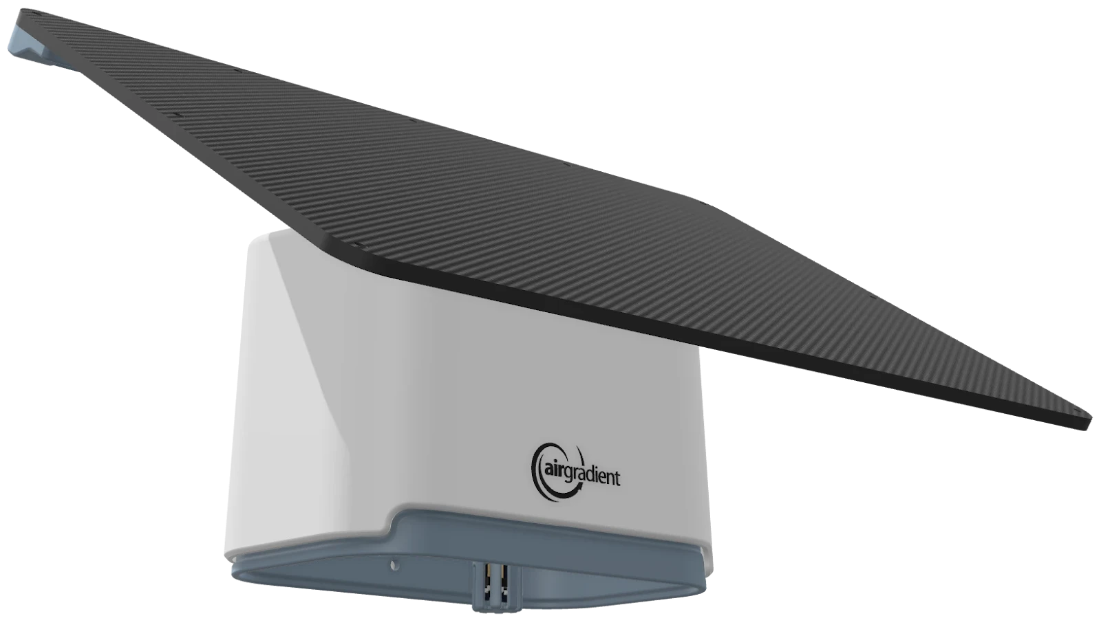
Figure 1: AirGradient Monitors
| Site Characteristics | Connectivity Options | AirGradient Model | Parameters Measured |
|---|---|---|---|
| Locations with reliable WiFi. Residential areas, schools, offices, community centers. | WiFi | Open Air | PM, CO2, VOCs (optionally without CO2 but dual PM) |
| Locations with cellular coverage, where WiFi is unreliable or unavailable. Areas with limited infrastructure, remote urban locations. Electric mains power is readily available. | Cellular (LTE Cat 1) | Open Air Cellular | PM, CO2, VOCs (optionally without CO2 but dual PM) |
| Locations with cellular coverage, where WiFi and electrical power is unreliable or unavailable. Also useful for very easy deployment as no setup to WiFi or electrical connection is needed. | Cellular (LTE Cat 1) & Solar Power | Open Air Max (Cellular & Solar) | Dual PM, CO2, NO2, O3, VOCs (optionally without NO2, O3) |
Cellular Connectivity Note: AirGradient cellular monitors use LTE Cat 1, a common cellular standard compatible in areas with smartphone connectivity. Check local cellular provider coverage maps to ensure adequate signal strength.
Solar Panel Note: The AirGradient Max utilizes a 10w solar panel that is suitable in latitudes from roughly 0 - 45N/S. In regions closer to the poles, a 2nd solar panel can be deployed to ensure a reliable energy supply.
We would recommend that you plan approximately 20% of the monitors as spare monitors in case you need to replace a malfunctioning monitor or you find out that you need to add an additional monitor at a specific location.
5. Frequently Asked Questions (FAQs)
Please refer to the topics below for the answers to frequently asked questions. If you have additional questions that are not answered in this section, please refer to the support section in the document.
Why is site selection so important for air quality monitoring?
The location of your air quality monitors directly impacts the data you collect. Carefully chosen sites ensure your data is accurate, representative of the air quality you want to measure, and useful for making informed decisions. Poor site selection can lead to misleading data and wasted effort.
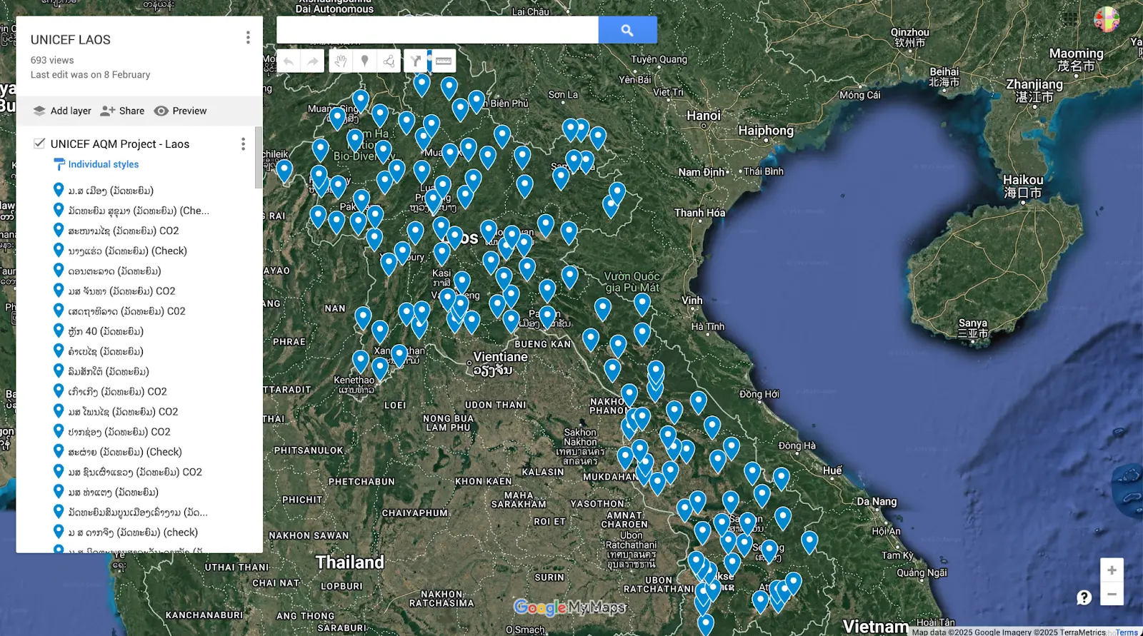
How can I use Google Maps “My Maps” for Site Planning?
Google Maps “My Maps” is a helpful tool for visualizing and planning your monitor locations across your city.
- Create a New Map: Go to Google My Maps and create a new map for your monitoring area
- Mark Potential Sites: Use the “Add marker” tool to mark potential monitor locations on the map.
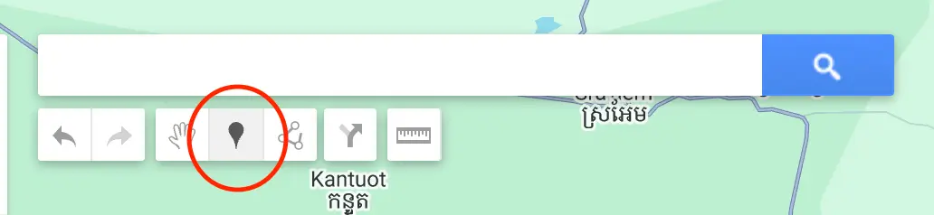
- Utilize Satellite Imagery: Switch to satellite view to examine the surroundings of each site. Use satellite imagery to identify potential pollution sources, wind obstructions, and general site characteristics.
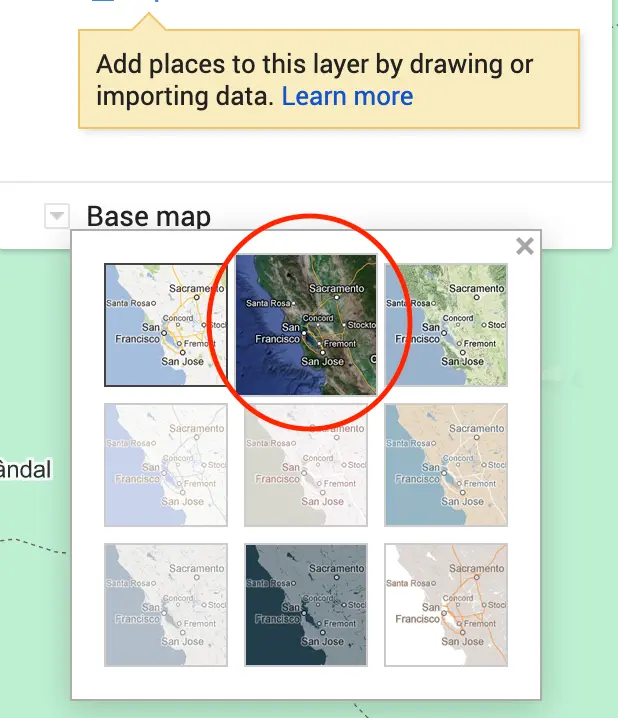
- Add Notes and Information: Add notes to each marker about power, network, accessibility, and environmental factors.
- Share and Collaborate: Share your map with your team to discuss and refine site selections.
Do I need to be an expert to choose good locations?
No, this guide provides you with the key considerations and a step-by-step process. By following these guidelines and thinking about your monitoring goals, you can effectively select appropriate sites, even without prior air quality expertise.
What if I can’t find a location that perfectly meets all the ideal criteria?
Perfect locations can be rare. Site selection often involves balancing different factors and making trade-offs. Prioritize the criteria most important for your specific monitoring objectives. Document any compromises you make and be aware of potential limitations in your data interpretation.
How do I test WiFi or cellular signal strength at a potential site?
The easiest way is to use a smartphone app designed to measure WiFi or cellular signal strength. Search for “WiFi signal strength meter” or “cellular signal strength meter” in your smartphone’s app store. Walk around the potential site with the app open to assess signal strength variations.
What if there are no power sockets available at my ideal monitoring location?
Consider using the solar-powered AirGradient Open Air Max model if sunlight is sufficient. Alternatively, explore options for running a power cable safely to the location, or consider slightly shifting the location to be closer to a power source while still meeting your other site selection criteria.
Can I place monitors near busy roads to measure traffic pollution?
Yes, if your objective is to assess traffic pollution. However, for general urban air quality assessments, it’s better to place monitors somewhat away from very immediate sources like roads to get a more representative reading of ambient air quality across a broader area. Ensure that the monitor placement corresponds with your air quality monitor objective.
What should I do if I suspect vandalism might be a problem at a particular location?
Choose a more secure location if possible. If the location is essential, consider using protective enclosures or tamper-proof mounting hardware to deter vandalism. Community engagement and raising awareness about the project can also help reduce vandalism risks.
How important is it to get permission to place monitors on public property?
It is crucial to obtain necessary permissions before deploying monitors on public property like lampposts or buildings. Contact your local city council or relevant authorities to understand the permitting process and obtain approval to avoid potential issues later.
Should I avoid placing monitors near trees?
It’s generally recommended to avoid direct placement on or under dense tree canopies. However, if a slightly treed area is otherwise the best location for your objectives, ensure the monitor is not directly touching trees, is exposed to some airflow, and is checked regularly for insect or debris buildup.
Reference instruments are high-precision, regulatory-grade devices used to measure air quality and calibrate other sensors. Typically operated by government or research institutions, they serve as the gold standard for air quality monitoring. See Chapter S7 Monitor Calibration and Reference Sensors vs Low-cost sensors for more information. ↩︎
Developed by AirGradient in Collaboration with the UNDP Global Centre Singapore CC-BY-SA