Data Sharing
The AirGradient platform provides users with the flexibility to share air quality data with multiple networks, including the AirGradient API, the AirGradient Map, and OpenAQ. This enables seamless integration with external platforms, fostering collaboration and contributing to broader air quality monitoring initiatives.
This document will focus on sharing data through the AirGradient Map and API, and through OpenAQ. If you want to learn more about how to use the API, please visit our document on the AirGradient API.
With a strong focus on data privacy and user control, AirGradient ensures that you retain full ownership of your data. You have the autonomy to decide whether to share your air quality readings publicly, contribute to open-source environmental research, or keep them private for personal use. We have detailed licensing and attribution requirements if 3rd parties use the data you share via the AirGradient platform. These requirements can be found here.
However, we highly recommend making data publicly available where possible to allow everyone in the community to benefit.
You own your data. Period.
We at AirGradient believe that the owner of our air quality monitors should own the data and have full control over it. If you read our terms & conditions, this is the first entry: “YOU own the data from your monitor”.
1. Sharing Data During the Onboarding Process
When setting up a new AirGradient Open Air monitor, go to the onboarding page: (https://app.airgradient.com/onboarding/welcome):
- Serial Number Entry:
- Choose the type of monitor model and configure the main settings.
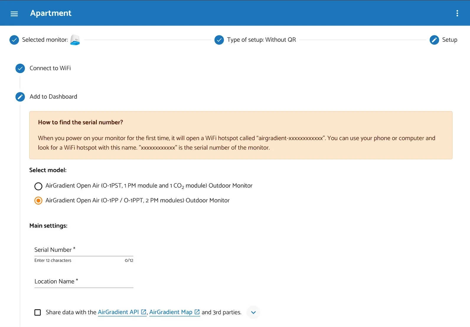
- Select Model and Main Settings:
- Enter the unique 12-character serial number found on the back of your device, or shown when connected to Wi-Fi.
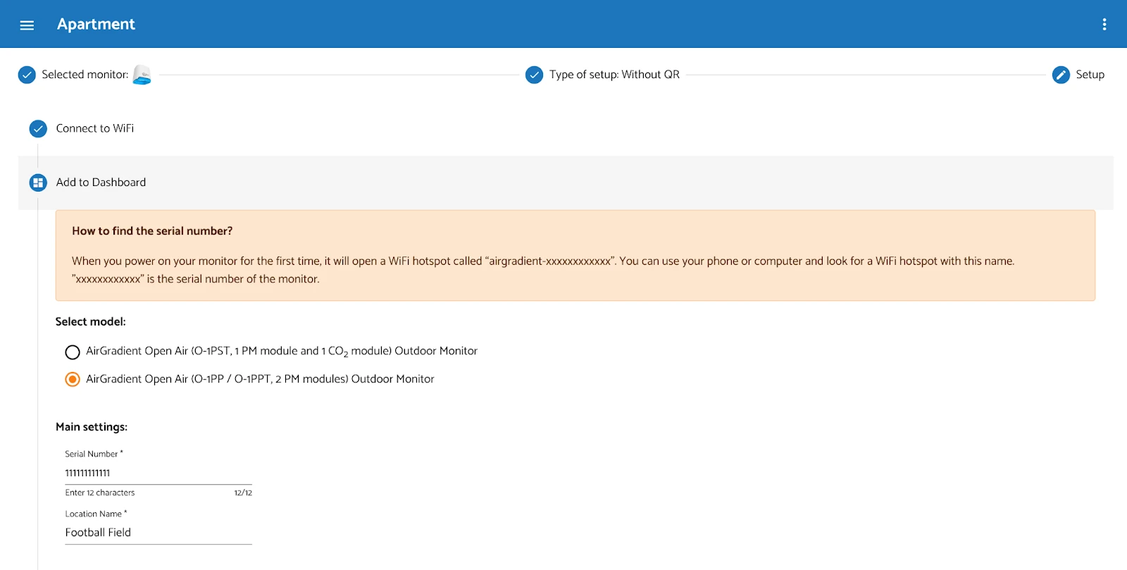
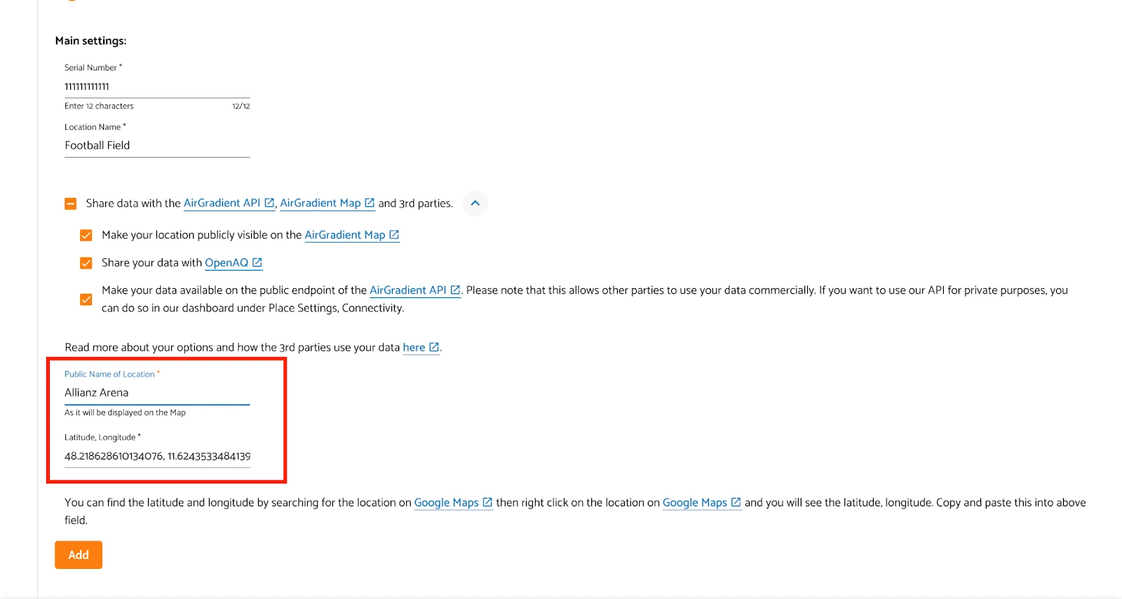
- Data Sharing Options:
- Just as in the Dashboard view, you will see the options to share data with AirGradient API, Map, and OpenAQ.
- Enter the location coordinates and contributor name (optional). The contributor name will then appear on the AirGradient map and also on the API.
By sharing your data, you become part of a community that is raising awareness about air quality worldwide!
2. How to share data (after setup)
If you have decided to share your data at a later stage, you can do so at any time. Go to the ‘Dashboard’ (https://app.airgradient.com/dashboard) page and follow the next steps:
Go to Edit Location
- Find the desired location on your Dashboard in the table of Outdoor Locations.
- Click on Edit Location
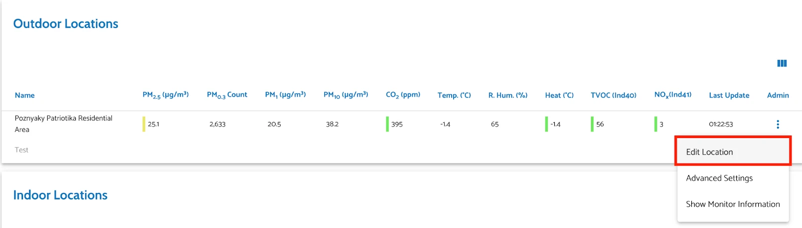
Figure 5: Edit Location menu item in location’s actions column - Go to the Data Sharing tab
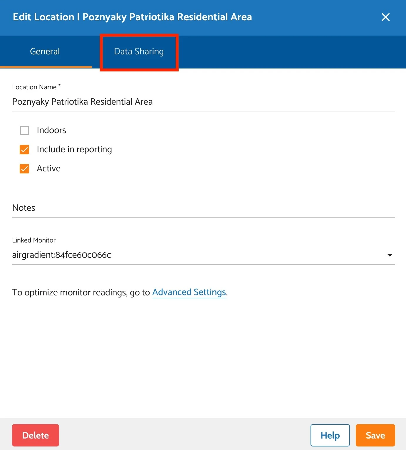
Figure 6: ‘Data Sharing’ tab in ‘Edit Location’ window
Choose Sharing Options:
- You will find checkboxes for sharing your data with:
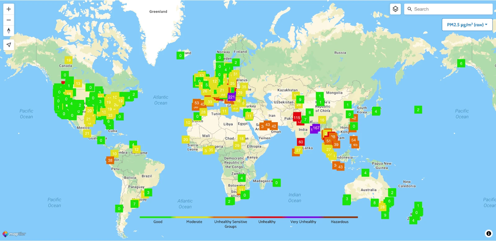
- AirGradient Map - a real-time, global map that displays air quality data, primarily sourced from open-source AirGradient monitors.
- OpenAQ - a global repository of air quality data used by many organizations and research institutions. AirGradient is an official partner of OpenAQ and strongly supports their mission, as well as share the same ethos around open data. By sharing data to OpenAQ,
- AirGradient API - allows access to air quality data from their open-source, open-hardware monitors, enabling users to integrate this data into other systems or applications.
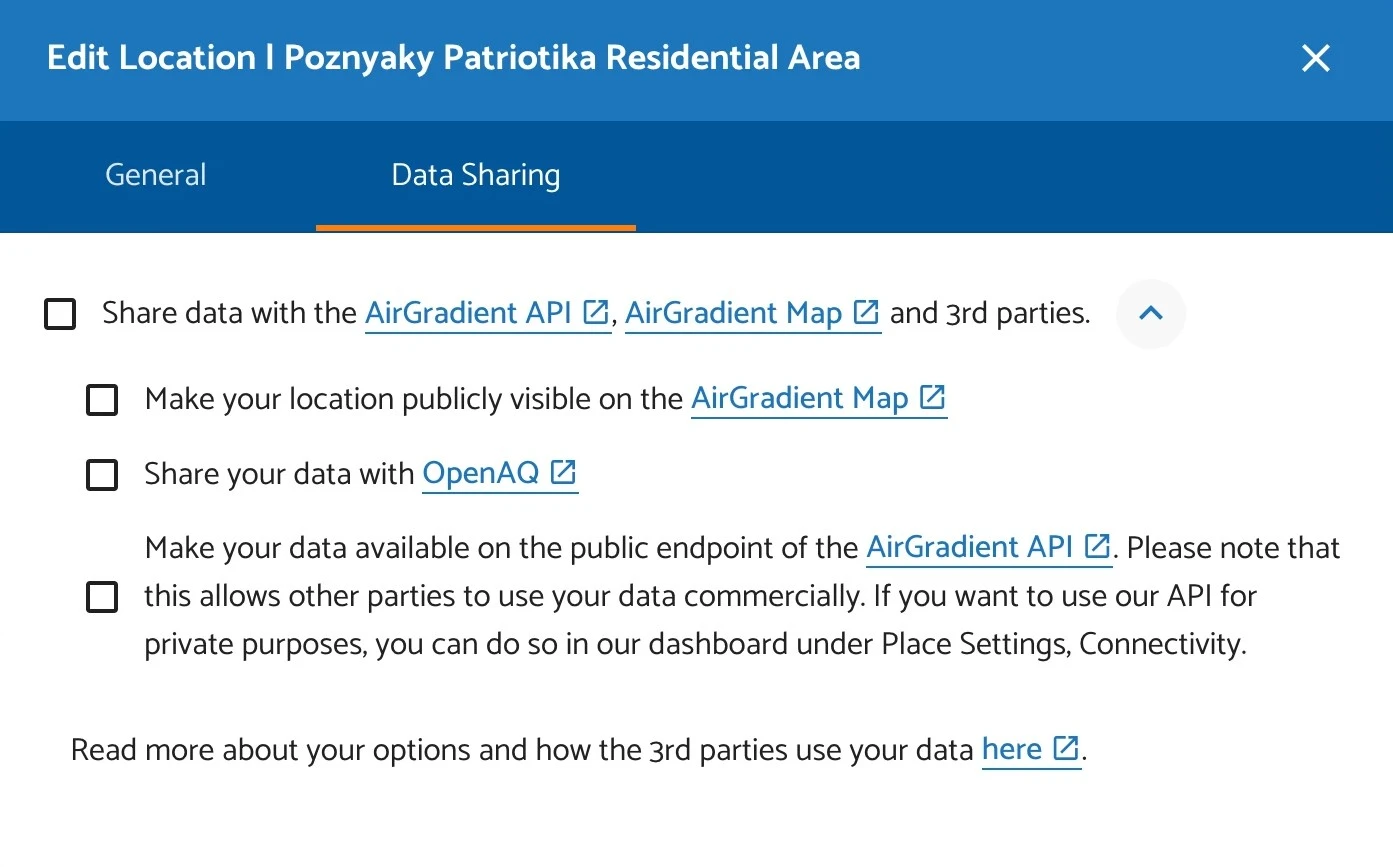
Figure 7: Sharing options on ‘Data Sharing’ tab - You will find checkboxes for sharing your data with:
Enter Location Information:
- Latitude & Longitude: You can copy your monitor’s coordinates from Google Maps.
- Location Name: Give a recognizable name to your monitor’s location.
- Public Contributor Name (optional): Add a name if you wish to be credited.
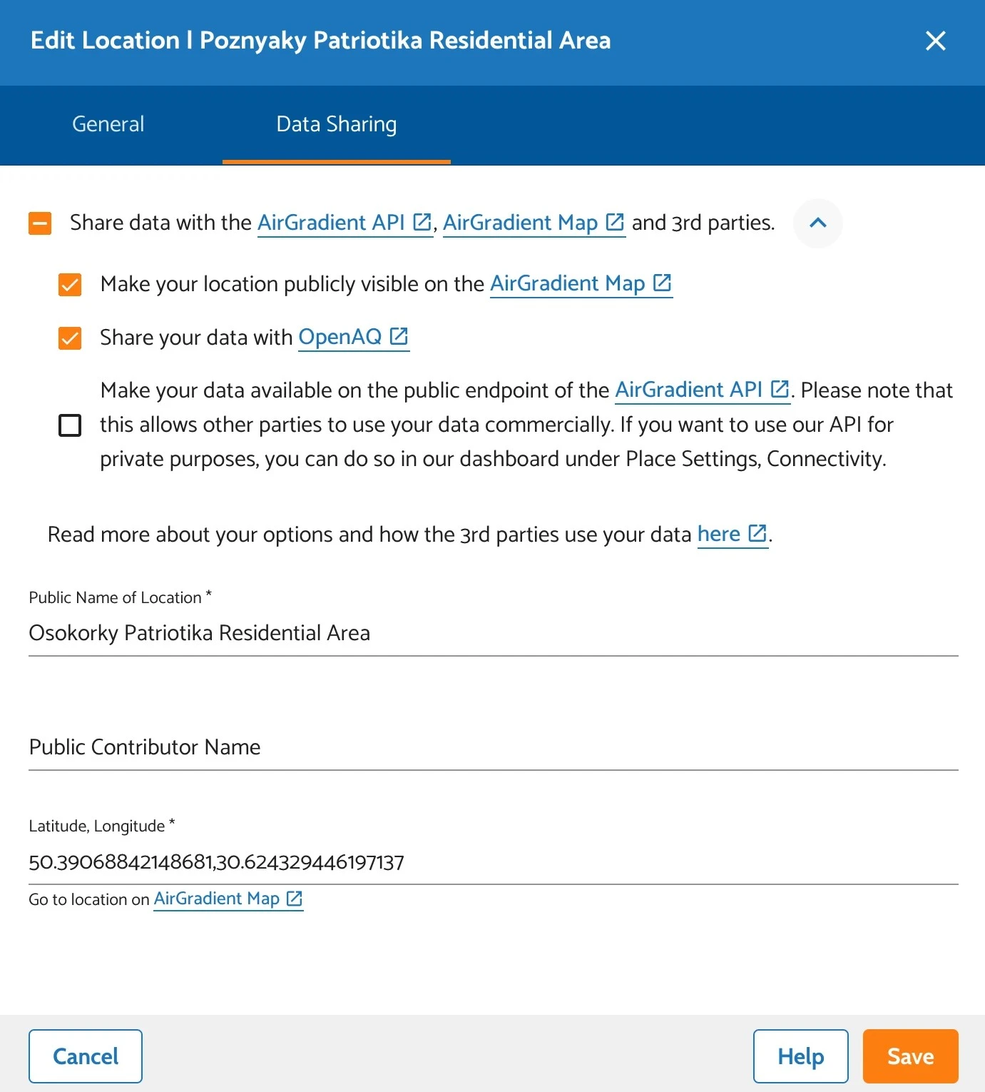
Figure 8: Filled up form on ‘Data Sharing’ tab
Please note that by pressing ‘Go to location on AirGradient Map,’ you will be taken to our map with the exact coordinates you entered earlier:
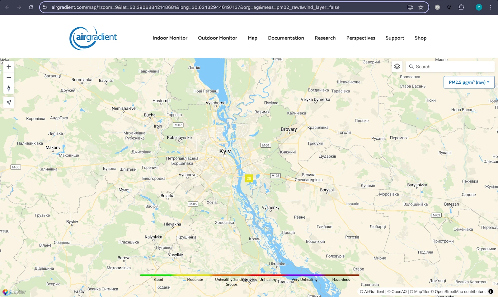
You can access the map by going to this link: https://www.airgradient.com/map/
3. Frequently Asked Questions (FAQs)
Here is the list of questions you may have when sharing your air quality data publicly.
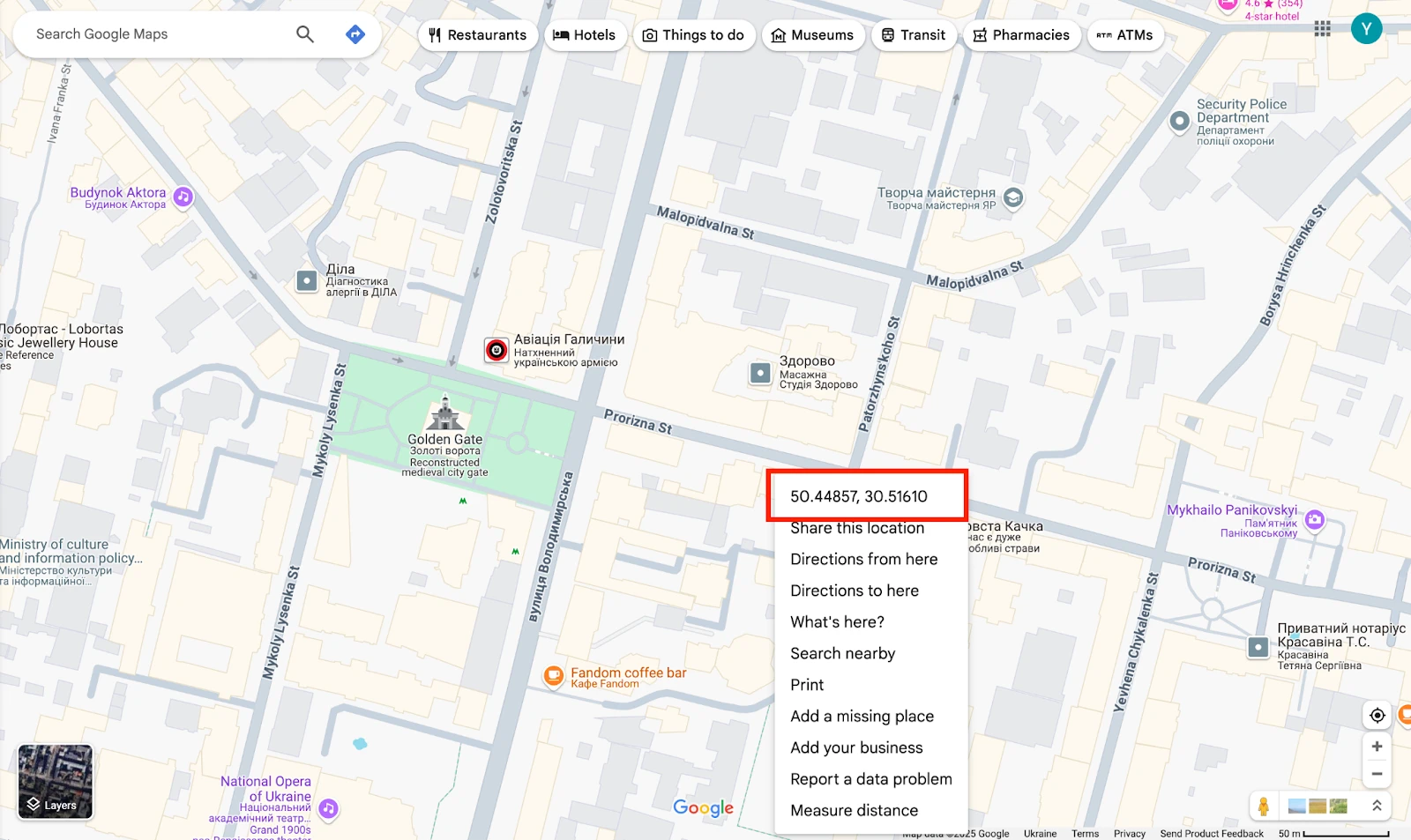
How can I get coordinates?
You can find the latitude and longitude by searching for the location on Google Maps then right click on the location on Google Maps and you will see the latitude, longitude. Copy (by right click on it) and paste this into the Longitude, Latitude field.
Why Share Air Quality?
By sharing air quality data publicly, you help:
- Increase transparency and accessibility of environmental information.
- Support research on pollution and air quality.
- Assist organizations like OpenAQ in creating cleaner and healthier environments.
Can I stop sharing my data after I have been sharing it for some time?
Anytime. It’s your data and your choice, so you are able to stop sharing at any time you like.
Any personal information needs to be provided too?
Not at all. All you need to do is provide the coordinates of the location where you set up your Open Air monitor and enter a name for this location. If you wish, you can also enter a public contributor name.
Developed by AirGradient in Collaboration with the UNDP Global Centre Singapore CC-BY-SA