Share Your AirGradient Outdoor Data Publicly on the AirGradient Map and OpenAQ
Share Your AirGradient Outdoor Data Publicly on the AirGradient Map and OpenAQ
AirGradient allows you to share your outdoor monitor data publicly. When enabled, your monitor data can appear on the AirGradient Map and, if selected, be shared with OpenAQ.
This article covers outdoor data sharing. Indoor data sharing is a separate, optional setting. Shared indoor data is privacy-protected and made available through the public Indoor Data API; it is not sent to OpenAQ or shown as an exact indoor location on the outdoor AirGradient Map. See Accessing AirGradient Global Indoor Air Quality Map and API and Data Obfuscation for Indoor Data Sharing.
Public sharing can be enabled either during the initial monitor onboarding process or later from the AirGradient dashboard.
Option 1: Enable Public Data Sharing During Initial Onboarding
When adding a new Open Air / Open Air Max monitor to the AirGradient dashboard, you will be asked whether you want to share your data publicly. See: Registering your AirGradient Open Air on the AirGradient Dashboard
During the onboarding process:
Add your monitor to the dashboard. Enter the monitor details, including the model, serial number, and location name.
When you reach the data sharing step, choose whether you want to share the monitor data publicly.
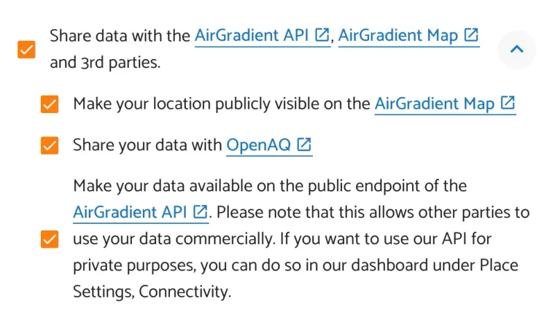
If you enable public sharing, you need to enter:
1. A public location name
The public location name is the name that may appear on public platforms such as the AirGradient Map and OpenAQ.
Choose a clear and specific public name for the location.
If you are sharing data with OpenAQ, the public location name should be unique. Very common names, such as only using a city name, may cause display issues on the OpenAQ side.
For example, instead of:
Yerevan
use something more specific, such as:
Yerevan - Arabkir Community Sensor
or:
Yerevan Open Air Max Station 01
2. The location coordinates
If you share your data publicly, you also need to provide the location coordinates for the monitor.
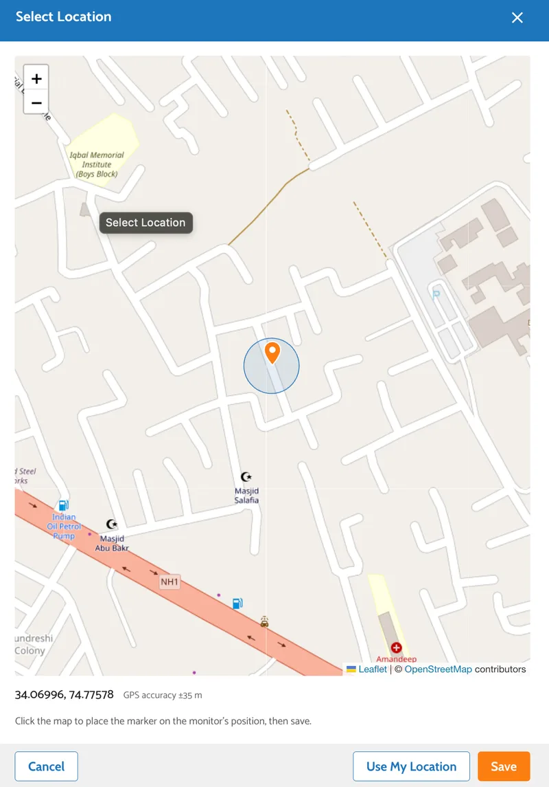
Tap the location pin beside the Latitude, Longitude input.

The location picker lets you:
- use your current location
- place the pin manually on the map
You can also enter the latitude and longitude from Google Maps:
- Open Google Maps.
- Right-click on the monitor’s location.
- Copy the coordinates shown in the menu.
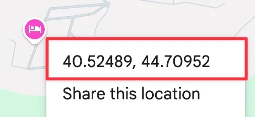
- Paste them into the location coordinates field in the AirGradient dashboard.
Example format:
40.1792, 44.4991
The coordinates should be accurate enough to represent the monitor’s outdoor location. For OpenAQ sharing, both the latitude and longitude must have at least three decimal places.
For example, these coordinates may be accepted by the AirGradient Map but may not be precise enough for OpenAQ:
7.14, 125.62
Instead, use at least three decimal places:
7.143, 125.625
This is important because coordinates with only two decimal places can represent a location roughly within 1 km of the actual monitor position, which is not precise enough for OpenAQ.
Option 2: Enable Public Data Sharing After the Monitor Has Been Added to the Dashboard
You can also enable or update public data sharing after the monitor has already been added to your dashboard.
To do this:
- Open the AirGradient dashboard.
- Go to Locations.
- Go to Admin for the relevant location.
- Click Edit Location.
- Find the Data Sharing section.
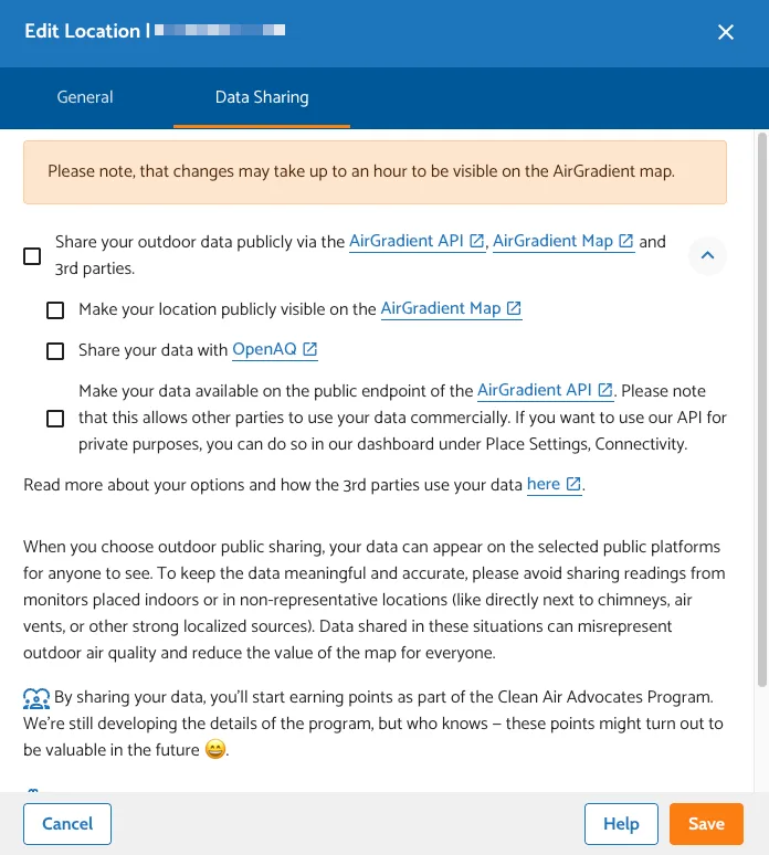
Here, you can choose whether you want to share the data publicly.
If public sharing is enabled, enter a public location name and the location coordinates according to the steps described above.
- Save the changes when finished.
For troubleshooting see: Why Doesn’t My Monitor Appear on OpenAQ or the AirGradient Map?